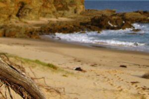
Photos And Information About Norman Bay at Wilsons Promontory
Norman Bay is the main open ocean beach east of Tidal River Camp Grounds and can be accessed from a variety of points along the main car park and easily from Tidal River itself.
 Swimming and Surfing – Most people can swim in the waters here though the signs clearly warn you to be aware of strong currents, submerged and slippery rocks and drop offs. For children, families and those who prefer milder waters, Tidal River just around the corner, is an ideal spot to sit and relax for the day. Surfing is only permitted south of the 5th ramp and the surf life saving patrols operate for those swimming between the flags through the main summer holiday months of December and January.
Canoe/Kayaking Tours and Abseiling Adventures – Canoe Tours operate at an advertised 10am, 2pm and 7pm daily through First Track Adventures. Exciting abseiling adventures start at 7am. Boat/kayak hire is also available and commonly enjoyed by newcomers as well as the experienced. Wilsons Promontory provides some of the most amazing scenery, excellent Bush Walking Tracks, easy camping and varied recreational activities in the whole of Australia.
Walking Tracks From Norman Bay – Heading north, the track starts between the Visitors Centre and the General Store and will take you on an easy to moderate 4km trek over sand dunes and through tea trees towards Norman Point and Little Oberon Bay with terrific views of the Anser and Glennie group of Islands. Norman Point is then only 300 metres from the main track. Heading south from Norman Bay, you can take an easy stroll along the beach and if you were to continue further, you could join another great track called Tidal Overlook which starts at the tidal river foot bridge. This area contains fabulous beaches, the peaceful Tidal River, attractive fern gullies, spectacular views, intriguing rock formations and plentiful sightings of wildlife, some native and some introduced.
 Floods At The Prom – In March 2011, extensive widespread flooding in the area eroded parts of the beach, the rivers, the roads and the hillsides, causing closure of the park while repairs were made. Most of the walking tracks are now better than ever and we expect the landscape will continue to change from the effects of wind, fire and water as time goes by. “After The Floods” pictures will be included in our photo gallery soon.
Mount Oberon at Wilsons Prom – The rocky outcrop called Mount Oberon sits high above this national park to the north west of Norman Bay, attracting walkers and visitors who like to enjoy the spectacular views of the coastline and the offshore islands from peak. It’s a great place to take photographs of magnificent sunsets and the expansive land and coastal wilderness.
Tidal River Camping Ground – The main camping area is directly to the west of Norman Bay Beach and offers a variety of campsites, cabins, huts and eco-friendly accommodation. Campsites are in great demand and bookings are required for all holiday periods. A ballot is held to allocate sites over the popular summer season.
Other Accommodation Near Wilsons Prom – There are an abundance of bed and breakfast, romantic getaways, cabins, motel rooms, family villas and farm stays just outside Wilsons Prom with Yanakie being the closest to the gateway. You might also like to take into consideration staying in towns such as Waratah Bay, Sandy Point, Foster, Fish Creek and Port Franklin which are within a 30 minute drive and generally also provide attractive views of the mountains and corner inlet. Meeniyan and Fish Creek are conveniently located right on the route between Melbourne and Wilsons Promontory.
Fabulous Pictures Of Wilsons Promontory National Park – are located on the page below.
Want To Know More? – For more information, use our convenient Search Page.


Leave a Reply
Feel free to leave a comment. We'd love to hear from you.